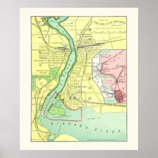
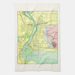
This poster features a detailed color map of the Niagara Falls and the adjacent towns and features on both the American (New York State) and the Canadian side (Ontario), published in 1885.
The map shows the Niagara river flowing from east of Grass island, over the waterfalls separated by Goat Island. Street maps for the towns of Niagara Falls and Clifton, and railway lines for Michigan Central and New York Central are shown in detail.
The map provides a fascinating insight to the populated areas beside this famous landmark at the turn of the 19th Century. A small map inset shows the falls in relation to Buffalo to the south and Lake Ontario to the north.
More Gifts With Niagara Falls, Vintage and Contemporary | ||
|---|---|---|
 Niagara Falls and Vicinity Vintage .. | 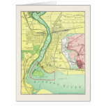 Niagara Falls and Vicinity Vintage .. |  Niagara Falls and Vicinity Vintage .. |
 Niagara Falls and Vicinity Map 1885.. | 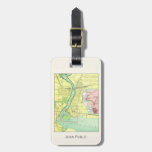 Niagara Falls and Vicinity Vintage .. |  Niagara Falls - Falls View Railway .. |


Browse and Shop for more Niagara Falls gifts at Zazzle
Recent tweets with the tag niagara falls |
|---|
|