Map of Gibraltar 1705 Vintage Fine Art Poster
Posted By David Paul on at Dreamgifts
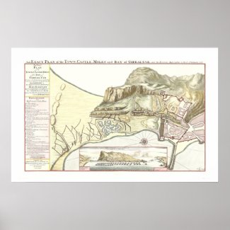
This poster features a colorful map of Gibraltar, published in 1705, entitled An Exact Plan of the Town, Castle, Moles (Sea Walls) and Bay of Gibraltar and the Enemies' Approaches on the 7 January, 1704 and 18th January, 1705. It is a comprehensive colorful visual description of Gibraltar in the days when it was a military garrison and is accompanied by detailed references to places marked on the map.
An inset shows a view of the town with the Spanish Mainland to the north and the Ape Hills, Ceuta and Tetuan Bay on the North African coast to the south.
Close-Up Views Of The Map
Options
For low-cost, long-lived posters, select Zazzle’s Value Poster Paper (Matte). This very white paper, used in the poster above, creates vibrant art and photo reproductions.
Other paper types include Archival Heavyweight Paper (Matte), designed for displaying highly saturated images without sacrificing print quality. Great for professional photographers and graphic artists on a budget, archival heavyweight matte paper delivers superior quality at a lower cost. Prints on archival heavyweight matte paper are fade-resistant and have a 90+ year archival rating.
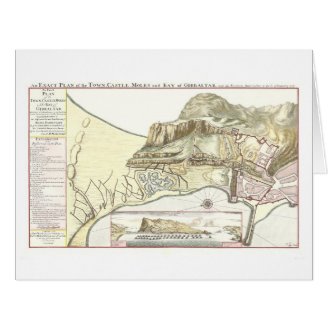
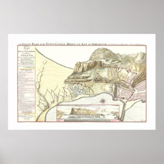
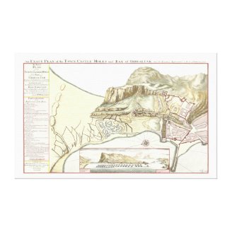
The map is available on a large greeting card and a wrapped canvas print in addition to a poster.
Map Legend
An Exact Plan of the Town, Castle, Moles and Bay of Gibraltar which shews all the fortifications on the land-side and Enemies' Approaches on the 7 January, 1704 and 18th January, 1705
Humbly Dedicated to His Highness George Land-Grave of Hesse Darmstadt,
Knight of the Golden Fleece and Captain General of His Catholick Majesty's Forces
By his mist Humble and Most Obedient Servant
Col:ol: D'Harcourt
Explanation of the References in this Plan
A St Paul's Bastion
B Curtain of St Bernard
C Bastion of St Peter
D L'Arquia
E The Round Tower
F The Communications in the Round Tower
G The Breaches in the Castle
H The Breaches in the line from L'Arquia upwards
I Breaches in the line from the Round Tower up to the Salto de Lobo (Wolf's Leap, North Face)
K Willis Battery
L PLace for another Battery proposed to Communicate north the line that goes from the Round Tower up Hill
M Another Battery
N Old Mole
O The Curtain from the Bastion of St Paul along the Water Gate
P The Ground for the Ravelin (V shaped fortification) Proposed to be made
Q Our Mines
R A Double row of Palisades which have been up along in the Moat
S Stone Bridge
T The Land Gate
V The Water Gate
U The Parade to be made and surrounded with Barracks for Soldiers
W Breaches made by the Enemy
X The Castle
Y The Solto de Lobo or the Catalan Guard
Z The Gate near the Castle which is now the communication to the Round Tower
a That part of the Enemies Trenches which the Garrison burnt and destroyed in the first sally they made at 8 o'clock in the evening which to this day but partly repaired by them. Unrepaired work may be distinguished by the headmost line marked only with small points.
b An entrenchment lately made by the Garrison behind the breach I that is before it.
d Part of the Town Towards the Land Gate
LONDON Sold by Edward Castle near Whit(e)hall, and David Mortier, Book, Map and Print Seller
at the Sign of Erasmus's Head, near the Savoy in the Strand
An inset shows a view of the town with the Spanish Mainland to the north and the Ape Hills, Ceuta and Tetuan Bay on the North African coast to the south.
Close-Up Views Of The Map
 |
| Close-Up of the Description of Garrison Features |
 |
| Illustration of The Rock of Gibraltar, 1705 garrison, with features annotated in the legend |
 |
| View of Gibraltar showing Spain to the north and Ceuta, North Africa to the south with fleet of ships in foreground |
Options
For low-cost, long-lived posters, select Zazzle’s Value Poster Paper (Matte). This very white paper, used in the poster above, creates vibrant art and photo reproductions.
Other paper types include Archival Heavyweight Paper (Matte), designed for displaying highly saturated images without sacrificing print quality. Great for professional photographers and graphic artists on a budget, archival heavyweight matte paper delivers superior quality at a lower cost. Prints on archival heavyweight matte paper are fade-resistant and have a 90+ year archival rating.
The map is available on a large greeting card and a wrapped canvas print in addition to a poster.
More Gifts With This Map |
|---|
 Vintage Map of Gibraltar 1705 Large Card.. |
 Vintage Map of Gibraltar 1705 Poster.. |
 Vintage Map of Gibraltar 1705 Canvas Stretched Canvas |
Map Legend
An Exact Plan of the Town, Castle, Moles and Bay of Gibraltar which shews all the fortifications on the land-side and Enemies' Approaches on the 7 January, 1704 and 18th January, 1705
Humbly Dedicated to His Highness George Land-Grave of Hesse Darmstadt,
Knight of the Golden Fleece and Captain General of His Catholick Majesty's Forces
By his mist Humble and Most Obedient Servant
Col:ol: D'Harcourt
Explanation of the References in this Plan
A St Paul's Bastion
B Curtain of St Bernard
C Bastion of St Peter
D L'Arquia
E The Round Tower
F The Communications in the Round Tower
G The Breaches in the Castle
H The Breaches in the line from L'Arquia upwards
I Breaches in the line from the Round Tower up to the Salto de Lobo (Wolf's Leap, North Face)
K Willis Battery
L PLace for another Battery proposed to Communicate north the line that goes from the Round Tower up Hill
M Another Battery
N Old Mole
O The Curtain from the Bastion of St Paul along the Water Gate
P The Ground for the Ravelin (V shaped fortification) Proposed to be made
Q Our Mines
R A Double row of Palisades which have been up along in the Moat
S Stone Bridge
T The Land Gate
V The Water Gate
U The Parade to be made and surrounded with Barracks for Soldiers
W Breaches made by the Enemy
X The Castle
Y The Solto de Lobo or the Catalan Guard
Z The Gate near the Castle which is now the communication to the Round Tower
a That part of the Enemies Trenches which the Garrison burnt and destroyed in the first sally they made at 8 o'clock in the evening which to this day but partly repaired by them. Unrepaired work may be distinguished by the headmost line marked only with small points.
b An entrenchment lately made by the Garrison behind the breach I that is before it.
d Part of the Town Towards the Land Gate
LONDON Sold by Edward Castle near Whit(e)hall, and David Mortier, Book, Map and Print Seller
at the Sign of Erasmus's Head, near the Savoy in the Strand
Recent tweets with the tag Gibraltar |
|---|
|